Harbour Quays
Description
Both Greater Wellington (GW) and Wellington City Council (WCC) confirmed through their Long Term Plans a programme of work to improve bus access to and through central Wellington.
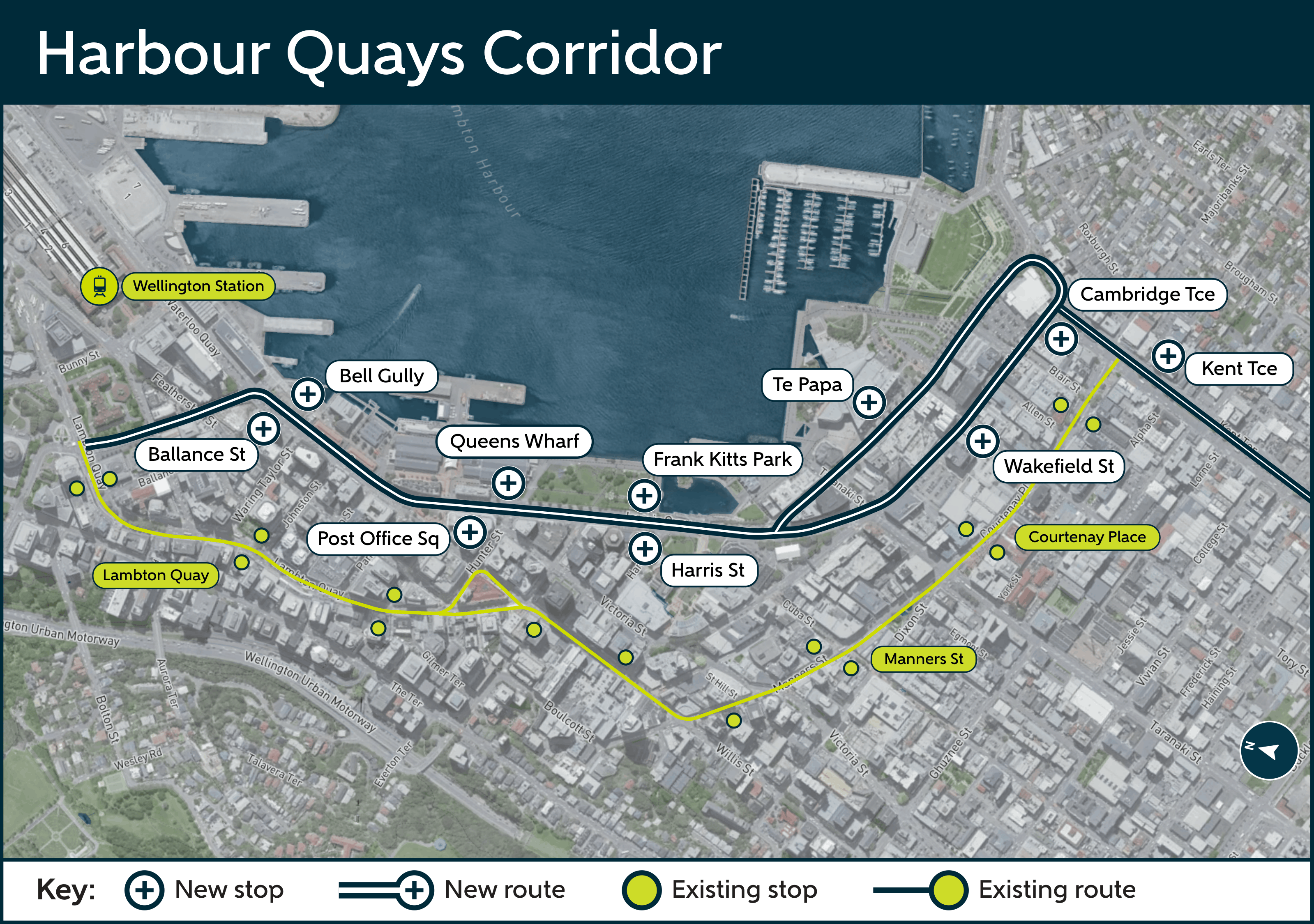
This includes the design and implementation of a proposed second city centre bus corridor along Harbour Quays, including Whitmore Street, Customhouse Quay, Jervois Quay, Wakefield and Cable Streets.
The Golden Mile bus corridor (Courtenay Place/Manners Street/Willis Street and Lambton Quay), is operating at higher than optimal capacity for bus operations, leading to increasing bus congestion and delays.
A second corridor would provide additional capacity to support increasing demand and city growth, while making it easier to travel to key destinations such as the hospital and airport.
Geographic scope of the project
Background
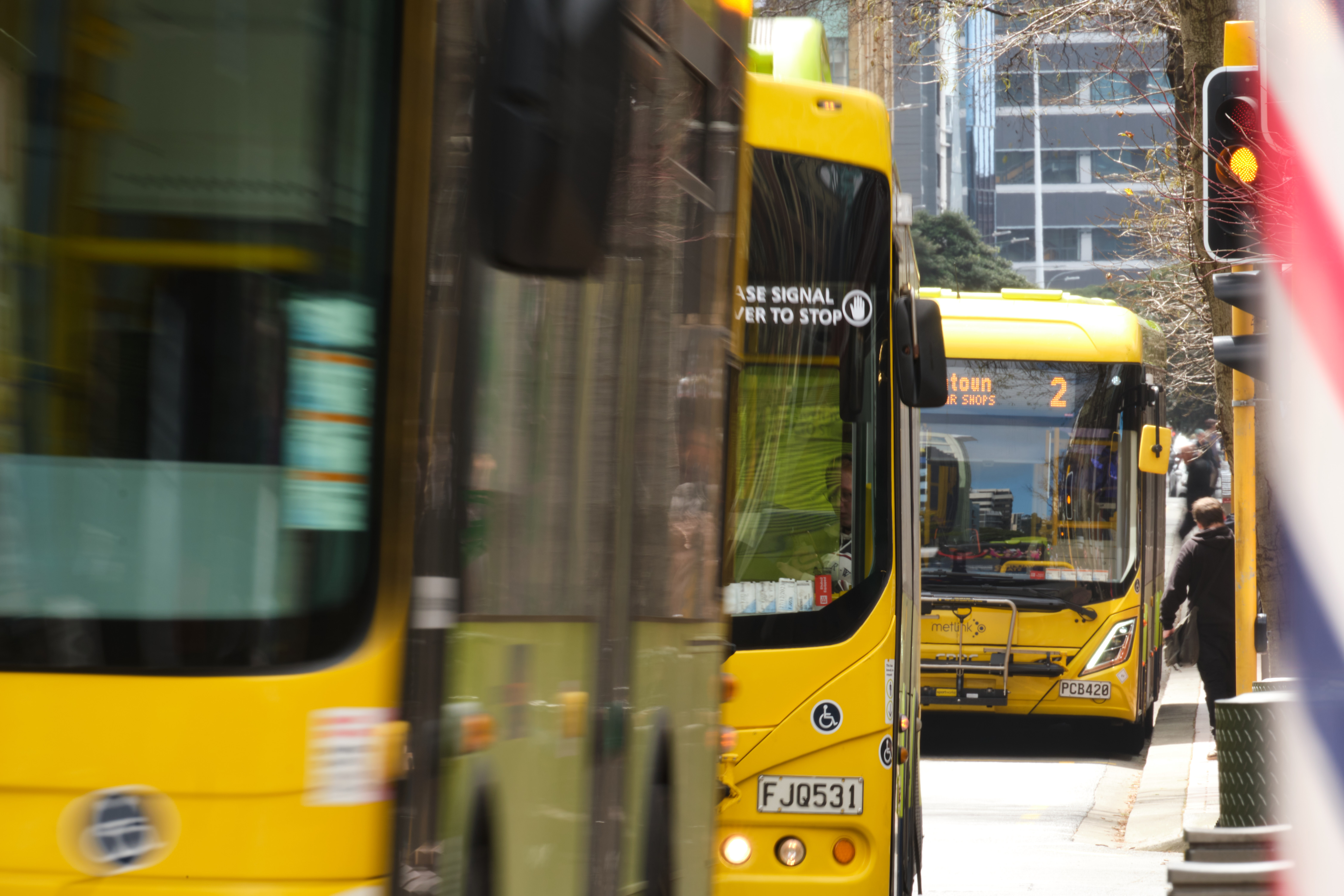
More people than ever before are using Wellington buses, which is a great thing for the city and the environment.
However, the high number of buses on the Golden Mile bus corridor (Courtenay Place/Manners Street/Willis Street and Lambton Quay) is contributing to slower trips through the central city.
To minimise delays and congestion the ideal capacity for the Golden Mile bus corridor would be limited to 50-80 buses per lane per hour. Having a second bus corridor along the waterfront means we can operate reliable and efficient services through the central city. This will also provide the capacity we need for growing public transport use.
Without this, trips through the Golden Mile are expected to become slower and less reliable, impacting people and businesses in the city centre.
Proposed Design
To address this, Metlink and WCC are planning a new bus corridor along the waterfront quays.
The aim is to improve our public transport services to be better, faster, more efficient and more attractive so we can move more people with fewer vehicles. We want Wellington to be an even better place to live, spend time and move around.
Proposed changes include peak-hour bus lanes, new bus stops, safety improvements, and some changes to parking and loading.
-
Southbound bus corridor: This will run from Wellington Railway Station via Whitmore Street, Customhouse Quay, Jervois Quay, Cable Street, and Kent Terrace to the end of Courtenay Place.
-
Northbound bus corridor: This will run from Courtenay Place via Cambridge Terrace and Wakefield Street, rejoining Jervois Quay and continuing to the Railway Station.
-
Bus lane: It is proposed a bus lane would operate in the kerbside lane in each direction between 6.30-9.30am and 3.30-6.30pm, Monday to Friday. This would be along Customhouse and Jervois Quays, Wakefield and Cable Streets.
-
Bus stops: These are proposed at key destinations along the route, and in proximity to existing bus stops on Courtenay Place, Manners Street, Willis St and Lambton Quay.
Benefits
The new bus corridor will:
Improve reliability and increase capacity through the city centre.
- Bus travel times on the Golden Mile currently vary by more than 30%, with the same trip taking up to 10 minutes longer or shorter.
Support faster journeys to key destinations such as Queens Wharf, Te Papa, and Wellington Hospital.
- Travel time savings are expected for routes using Harbour Quays (for example, around 7 minutes on Route 24) and for routes remaining on the Golden Mile (around 2 minutes on Route 2).
Reduce congestion on the Golden Mile, which already operates at high bus volumes during peak times.
- International guidance suggests 50–80 buses per lane per hour is optimal. The Golden Mile currently carries 79–99 buses per lane per hour at peak, and this is expected to increase to 126–137 by 2034.
It will also provide an essential detour option that can be used when needed.
Planning
The current concept proposes express services from the Wellington Station bus interchange and Bowen Street to travel and stop along Whitmore Street, Customhouse Quay, Jervois Quay, Cable Street and Wakefield Street and connecting near Courtenay Place on Kent and Cambridge Terraces.
The stops will be sheltered and near key attractions along the waterfront including the Tākina convention and exhibition centre and Te Papa.
Next steps
Consultation on the proposed changes will occur from 19 May – 14 June 2026. Following consultation both councils will be asked to approve the Harbour Quays Business Case and Wellington City Council will be asked to approve the traffic resolutions to make these changes occur.
Want to be kept updated?
Sign up to the WCC mailing list to stay in touch about bus priority projects around Wellington.
Read Greater Wellington’s public transport submission on Wellington City Council’s Long-Term Plan: